Hi there,
when you build PC standalone be sure that terrain shaders are included in your project.
- Nature/Terrain/Diffuse
- Nature/Terrain/Specular
- Nature/Terrain/Standar


Result from Standalone
Hi there,
when you build PC standalone be sure that terrain shaders are included in your project.
Result from Standalone
GIS Terrain Loader Updated to v1.9
Released date : Sep 12, 2020 (Pending Review)
Updates :
/////////////////////////////////////////////////// GTL Editor Updates ////////////////////////////////////////////////////////
/////////////////////////////////////////////////// GTL Runtime Updates ////////////////////////////////////////////////////////
(Editor) Procedural Terrain splatmap video Tutorial

(Runtime) Procedural Terrain splatmap Result
Tutorial exist in demo scene folder;
I’m thinking of buying GIS Terrain Loader plugin. I know that it can generate roads from OSM data. Will the plugin generate buildings from OSM data?
Hi there,
GTL actually generate roads,Grass and trees from OSM Vector data.
we are working on it, GIS terrain loader 2.0 will also support building.
I’m not sure if I buy the plugin now or wait for V2.0. I was not happy with another plugin that generates roads and buildings from OSM data.
Hi there, if you only need buildings and roads you can use another.
Just Take your time to think about needs of your project and which asset that will realy help you.
As the 2.0 not released yet, you can give me some idea about what do you want exactly in your project maybe i can customize a part of the GTL asset for you. (New version need at least 10 days)
I wish to create a driving game in a city. Think GTA. The other plugin is very slow in generating buildings, roads, and terrains. I tried generating in groups of 4X4 terrains but the edges of terrains in one group don’t match those in another group.
Hi there
Take a look on BuildR Procedural Building Generator asset.
I don’t have $150 for BuildR Procedural Building Generator asset.
I would like to ask, why is this and where is the problem
Loaded Zone Bounds : P1 - {12018159.109,5037755.431} P2 - {12018159.109,5037755.431}
UnityEngine.Debug:Log(Object)
Terrain Dimensions : 0 X 0 Km
UnityEngine.Debug:Log(Object)
Can’t detecte terrain dimension please try againe .
UnityEngine.Debug:LogError(Object)
Hi there
It seems that you have somethings wrong with your DEM file projection.
Please precise which file type do you want to generate, your GTL version, unity version, Editor or Runtime.
Could you upload your file please.
Best Regards
GIS Terrain Loader Updated to v2.0
Released date : Oct 29, 2020
Updates :
/////////////////////////////////////////////////// General Updates ////////////////////////////////////////////////////////
/////////////////////////////////////////////////// GTL Runtime Updates ////////////////////////////////////////////////////////
For any unity compatibility issues please contact us;
Runtime Airplane demo scene
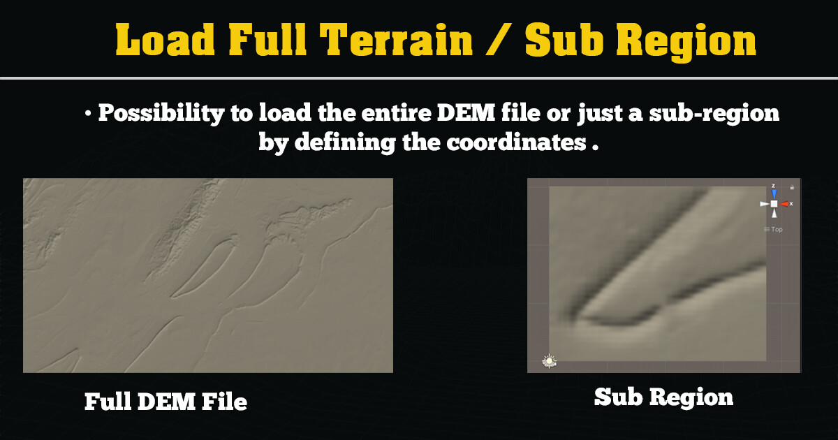
Load Full DEM File or Sub Region by coordinates
Auto Detection terrain tiles
Set manually terrain tiles ( producing Splitting /Merging )
Hi great asset so far!
A couple of questions, I am working on a project using your asset trying to get in large areas of data.
We have brought in our own ASCI data provided by government scans. This data has chunks of data missing so we would like to underlay the STM satellite image. We are having trouble merging them and keeping the height data. How would you go about this?
We also have an issue with the accuracy of elevation. It seems this problem comes from merging the tiles as a UInt16 as recommended in your tutorials leaving us with inputs like this:
How do we get around this without smoothing which reduces the quality?
Any help would be great, again an amazing asset!
Hi there,
Thanks for using GIS terrain Loader.
If you have a lot of chunks you need to merge and export them to one of the supported files.
In your case you merged your files by QGIS application, this may cause an accuracy problem.
1- So please upload at least tow chunks to me i will try to find an optimal way to resolve your merging issue.
2-Which GIS Software are you using
3- if we can not manipulate your files by Free GIS Software, in that case i have to integrate an option to load multiple terrain file.
Best Regards
Great asset! I am interested in it. I have a question, could it support very huge terrain, such as one or several provinces of China? We have such a project involving such an huge area.
Hi there
GIS terrain load support large terrain in the limite of memory use. (I tested an area of 60 km with sat images level 17 it works perfectly).
Load large terrain ex more than 100km with height texture resolution will consume a lot of memory, so the solution to do that is to make some streaming system or loading only the tile where the player is.
We are working on such type of asset but still no released in the asset store.
Hi, I also have this problem, almost every DEM file I tried to upload has this problem with the terrain dimensions.
I use unity 19.3.6, and i tried to upload a Raw file by the editor.
Thanks.
Hi there, Raw file does not have real world dimensions, in that case you have to set manuelly your dimensions file in km.
Aslo there is some files not projected in geographic Lat Lon, so GTL can not detect them.(please check examples file asset)
If any one has the same problem with specific file please contact me in the private to solve your issue.
Best Regards
Hey, Im trying this out at home in Unity 2020, but we only have Unity 2018.4.7 at work. It sounds stupid to ask but do you have a version that runs in 2018.4.7 still? Im mostly on Telework due to the pandemic these days. We would purchase another license for any additional install locations of course.
So, it wont load in 2018.4.7 cause thats too old, I tried loading into my new 2020.1.6f and I immediately get these errors:
I will browse this forum for answers but if you have any suggestions I would appreciate. thanks